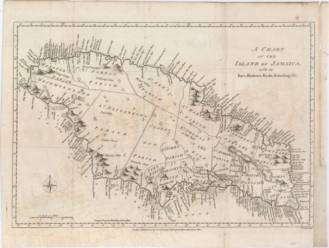
"A Chart of the Island of Jamaica, with Its Bays, Harbours, Rocks, Soundings, &c.", Bew, John
Subject: Jamaica
Period: 1780 (dated)
Publication: Political Magazine
Color: Black & White
Size:
15 x 10.2 inches
38.1 x 25.9 cm
This striking map of Jamaica is divided into the counties of Cornwall, Middlesex, and Surry and subdivided further into a number of parishes. The map is teeming with detail along the coasts, with a myriad of bays, rivers, harbors, cliffs, coves, and the like named. In the water, reefs, anchorages, and soundings are shown. There is considerably less detail inland, although many mountains are depicted, including the Blue Mountains. A compass rose capped with a fleur-de-lis appears at bottom left. Engraved by John Lodge. This lot comes with the related four page article titled "Discovery and Settlement of Jamaica..." from the August 1780 issue of Political Magazine.
References: Jolly #POL-10.
Condition: B
Issued folding, now flattened, on watermarked paper with light offsetting and a couple fold separations that have been closed on verso with archival materials. There is a binding trim at right that has been replaced with old paper and an associated 2" binding tear that has been closed with archival materials.