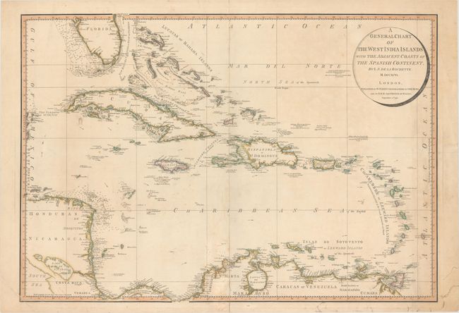
"A General Chart of the West India Islands with the Adjacent Coasts of the Spanish Continent", Faden, William
Subject: Caribbean
Period: 1796 (dated)
Publication: General Atlas
Color: Hand Color
Size:
29.6 x 20.6 inches
75.2 x 52.3 cm
This attractive chart of the West Indies was drawn by Louis Stanislas Delarochette and published by William Faden in 1796. It extends to cover the southern tip of Florida and portions of Central America and northern South America. The map is extremely detailed, and filled with information on coastal features, soundings, shoals, anchorages and currents. Decorated by a simple, circular title cartouche.
References:
Condition: B
There are two 0.5" tears in between Cuba and Central America that have been closed on verso with archival material, as well as a few extraneous creases and minor soiling. The centerfold has been reinforced to repair a few tiny separations and there are a few repaired edge tears confined to the blank margins.