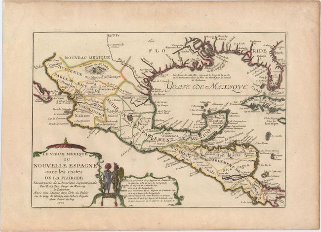
"Le Vieux Mexique ou Nouvelle Espagne avec les Costes de la Floride...", Fer, Nicolas de
Subject: Gulf of Mexico and Caribbean
Period: 1702 (dated)
Publication: Atlas Curieux ou le Monde…
Color: Hand Color
Size:
13 x 9 inches
33 x 22.9 cm
This attractive small map covers the Gulf of Mexico through Central America and includes parts of Cuba and Jamaica. It extends through Mexico to show the southern tip of Baja California. This is an early map to show the correct location of the Mississippi River delta gleaned from the expeditions of La Salle and Iberville. Two French forts are located: LaSalle's Fort St. Louis in Texas (Fortbati en 1685) and another near present-day New Orleans. One of the prominent features in northern Mexico is Les Fameuses Mines de Ste. Barbe, the legendary Santa Barbara mines of the Chihuahua-Durango region. The large cartouche features two native figures.
References: Pastoureau, FER I [111]; Lowery #254.
Condition: A
Original outline color on watermarked paper with later coloring in the cartouche. Light toning along sheet edges.