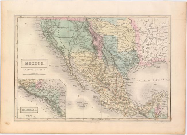
"Mexico, California & Texas", Black, Adam & Charles
Subject: Southwestern United States & Mexico
Period: 1848 (circa)
Publication: Black's General Atlas
Color: Hand Color
Size:
14.6 x 10 inches
37.1 x 25.4 cm
Early edition of this map featuring a vast California stretching to the Rockies, labeled as Upr. or New California. The rivers of the Gold Region are well shown and Ft. Sutter is located, but there is no mention of gold. Texas has an unusual shape here, with the panhandle extending north to the Arkansas River. New Mexico is a sliver of a territory between the oversized California, Texas, and Indian Territory, which starts at Red River and stretches north and to the west, over the Texas panhandle to the eastern edge of the Rockies. The map features a pre-Gadsden Purchase border between Mexico and the United States. There is good detail of the Californian missions and early forts throughout the Southwest. The Great Salt Lake, a Mormon settlement, and the Youtas all appear in the large California territory. Inset map of Central America at lower left. Finely engraved by Sidney Hall.
References:
Condition: A
A few minor spots and faint toning along the sheet's edges.