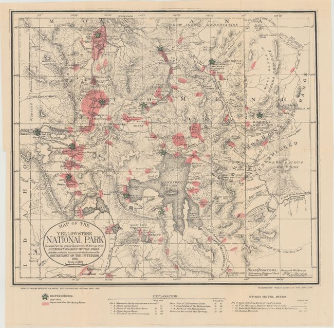
"Map of the Yellowstone National Park Compiled from the Official Explorations & Surveys of the Superintendent of the Park...", Donaldson, Thomas
Subject: Yellowstone, Wyoming
Period: 1881 (dated)
Publication: Public Domain
Color: Printed Color
Size:
17.2 x 15.3 inches
43.7 x 38.9 cm
This map is from the 5th Annual Report of P.W. Norris, Superintendent of Yellowstone National Park, and reissued in Donaldson's Public Domain. The map itself is very detailed and locates the Upper, Shoshone, Gibbon, and Heart Lake Geyser Basins, Mud Geysers, and Mammoth Hot Springs to name a few. It shows geysers and hot springs in pink and planned hotel sites (12 in all) marked with large green stars. Topography is indicated through hachure. This map provides an early look at Yellowstone and the government plans for its development.
References:
Condition: B+
Issued folding with a 6" separation along one fold that has been closed on verso with archival tape. There is a binding trim at left and an associated binding tear that just enters the neatline and has also been closed on verso with archival tape.