Catalog Archive
Auction 149, Lot 284

"The State of South Carolina: from the Best Authorities", Lewis/Carey

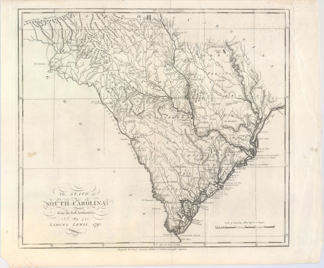
Subject: South Carolina

Period: 1795 (dated)

Publication: Carey's American Atlas

Color: Black & White

Size:
17.4 x 15.4 inches
44.2 x 39.1 cm
Download High Resolution Image
(or just click on image to launch the Zoom viewer)

This is the first state of this fascinating map of South Carolina that came from the first atlas of America published in America. The topography of the state is shown in fine detail, as are precincts, towns, waterways, and roads. As a result of the distorted scale of the latitude measurements, the state appears stretched from north to south. In addition, the northwest border with Georgia extends Carolina farther west than is accurate. Two of the most influential names in American cartography were Samuel Lewis and Mathew Carey. Samuel Lewis was a celebrated draftsman and cartographer who learned his trade from the prominent English cartographer Aaron Arrowsmith. Engraved by William Barker.

References: Phillips (A) #1362-3; Wheat & Brun #601.

Condition: B+

There are centerfold separations at top and bottom, as well as a slight tear just entering the neatline, all of which have been professionally repaired. There are also two tiny pinholes, an extraneous crease, and a small stain at left.

Estimate: $950 - $1,200

Sold for: $475

Closed on 5/21/2014

Archived