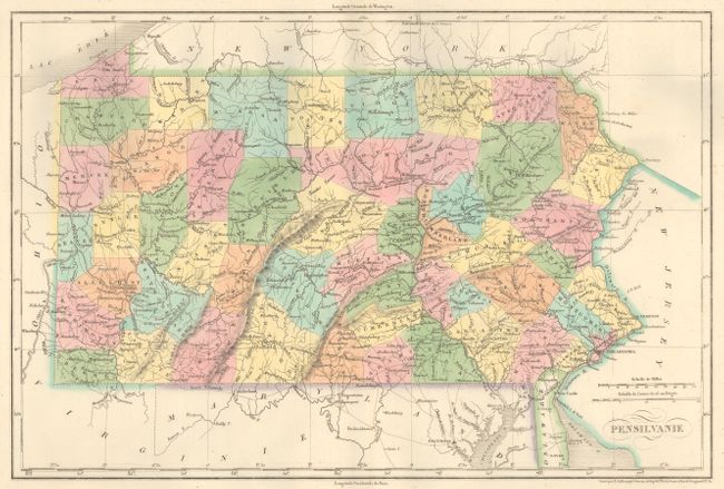
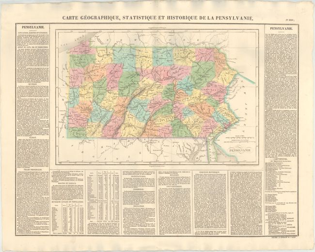
"Carte Geographique, Statistique et Historique de la Pensylvanie", Buchon, Jean Alexandre
Subject: Pennsylvania
Period: 1825 (circa)
Publication: Atlas Geographique, Statistique, Historique et Chronologique…
Color: Hand Color
Size:
17.3 x 11.4 inches
43.9 x 29 cm
This attractive copper engraved map is surrounded on three sides with French text describing Pennsylvania, its history, products, climates, and other information. McKean, Jefferson, and Potter are depicted although they were not officially counties until 1826, 1830, and 1835, respectively, while the eastern border of Clearfield appears in its 1822 configuration. Buchon produced the French edition of Carey & Lea's American Atlas. He used a better quality paper and today his maps are generally found in better condition than their American counterparts. The dimensions given are for the map only; overall, the large folio sheet measures 26.4 x 21.0".
References:
Condition: A
Original color on a clean, bright sheet of sturdy paper with a small abrasion in the text column to the right.