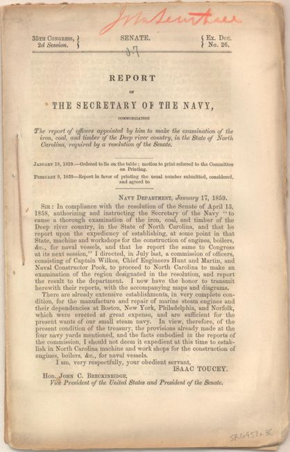
"[Lot of 3] Map of the Deep River District North Carolina [and] Map of a Part of North Carolina Showing the Routes Connecting with Deep River District Constructing & Proposed [and] Report of the Secretary of the Navy…", U.S. Navy Dept.
Subject: Southeastern North Carolina
Period: 1858 (published)
Publication: Sen Ex. Doc 26, 2nd Sess., 35th Cong.
Color: Hand Color
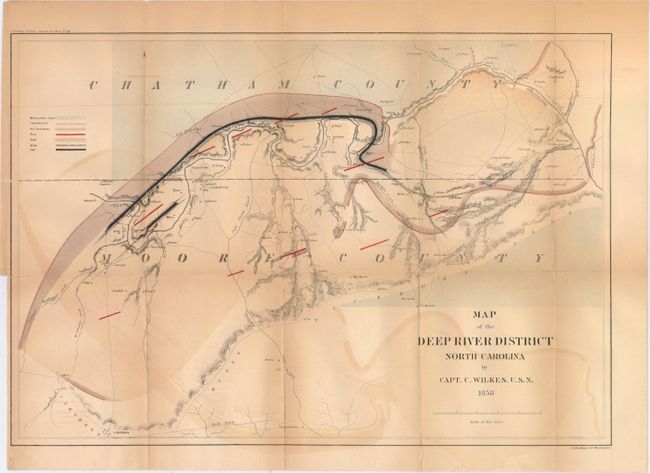
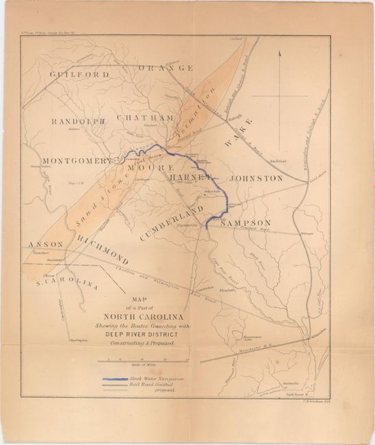
This report was a result of a Senate resolution intended for "expediency of establishing, at some point in the State, machine and workshops for the construction of engines, boilers, &c., &c., for naval vessels." Captain Wilkes led this effort and determined that the Deep River District would be a favorable area for such operations. Included with the 29-page disbound report is one plate and the following two maps:
A. Map of the Deep River District North Carolina (19.2 x 13.1"). Focused on the Deep River dividing the counties of Chatham and Moore, the map identifies the coal field and slate deposits following the river. Seven different geologic types are represented. On a detailed scale of 0.75" per mile. Condition: Issued folding with moderate color offsetting and several fold separations that have been partially closed on verso with archival tape.
B. Map of a Part of North Carolina Showing the Routes Connecting with Deep River District Constructing & Proposed (7.8 x 9.1"). This is a wider view of the area showing how the transportation network was connected to the Deep River District. Locates the Charlotte and Wilmington R.R., Wilmington and Raleigh R.R., as well as several proposed roads. Condition: Issued folding with light toning primarily along the folds and one fold separation.
References:
Condition: B
Report and plate are good with faint toning and a few minor edge tears. See description above for condition of maps.