Important Revolutionary War Map
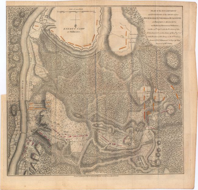
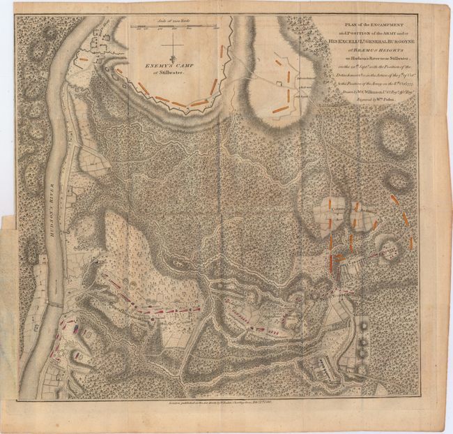
"Plan of the Encampment and Position of the Army under his Excelly. Lt. General Burgoyne at Braemus Heights on Hudson's River near Stillwater...", Faden, William
Subject: Colonial New York, Revolutionary War
Period: 1780 (dated)
Publication: A State of the Expedition from Canada…
Color: Hand Color
Size:
13.9 x 13.3 inches
35.3 x 33.8 cm
This detailed and uncommon battle plan shows the placement of British and American forces during the Battle of Saratoga, which took place during the months of September and October 1777. The two battles were fought nineteen days apart, and the interesting overlay at bottom left shows the change in positions of the two armies over that time period, with the Americans advancing north (with north oriented to the bottom). This was a key victory for the Americans. The map uses hand color to depict the troop positions and is from John Bourgoine's A State of the Expedition from Canada..., published in London. Faden's maps of the American Revolution are particularly well presented because he based them on manuscript maps supplied to him from the war zone.
References: Nebenzahl (Biblio) #56; Nebenzahl (Amer. Rev.) #22.
Condition: B+
Issued folding with light toning and offsetting and a binding trim to the neatline at upper left.