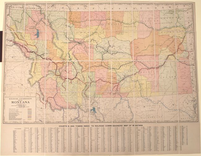
Large, Attractive Railroad Map of Montana
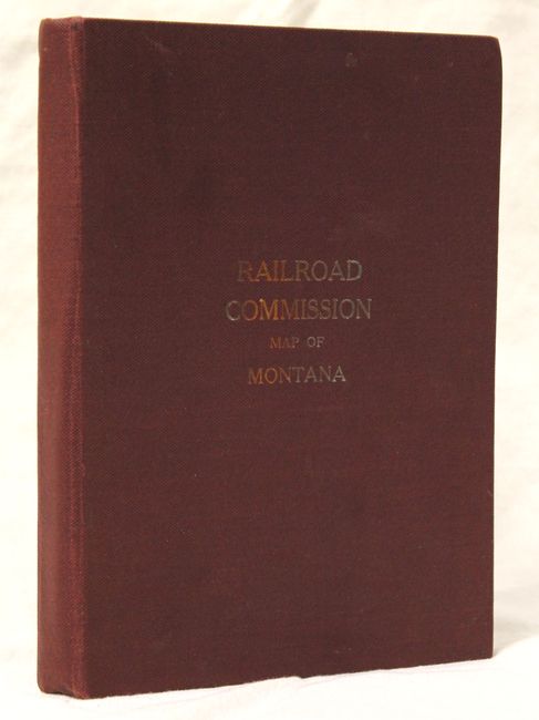
"Railroad Commission Map of Montana", Rand McNally & Co.
Subject: Montana, Railroads
Period: 1917 (dated)
Publication:
Color: Printed Color
Size:
51.4 x 32.3 inches
130.6 x 82 cm
This scarce, large detailed map of Montana displays all the current and proposed railroad lines in the state through the use of bold color overprinting. The map extends to include portions of Idaho and Wyoming (including Yellowstone) and depicts the lines of the Northern Pacific Railway, Great Northern Railway and the Chicago, Milwaukee & St. Paul Railway to name a few. Counties are displayed in full color and towns, villages, Indian Reservations and National Forests are located. Across the lower portion of the map is a large town and county index keyed to the map. The map was engraved and published by Rand McNally for the Montana Railroad Commission. Dissected and backed with linen and folds into maroon cloth covered boards measuring 6.0 x 8.5".
References:
Condition: A+
The map is clean with bright color and flawless. The cloth covers show only minor wear.