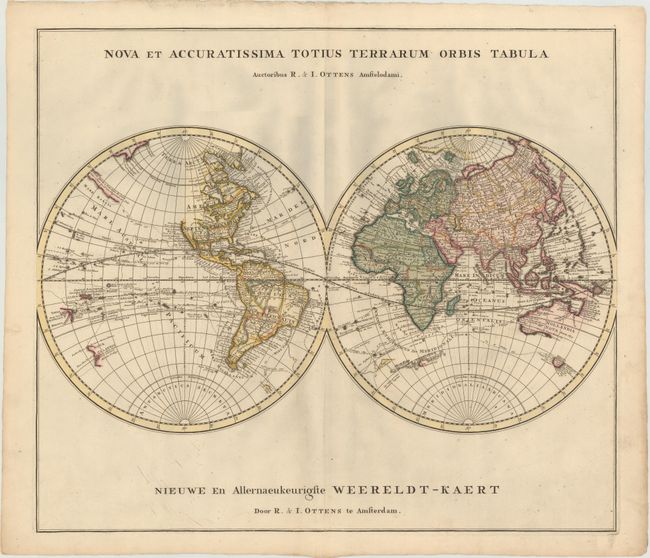
"Nova et Accuratissima Totius Terrarum Orbis Tabula / Nieuwe en Allernaeukeurigste Weereldt-Kaert", Ottens, Reiner and Joshua
Subject: World
Period: 1740 (circa)
Publication:
Color: Hand Color
Size:
23.3 x 20.3 inches
59.2 x 51.6 cm
This attractive double hemisphere map shows North America with an incomplete coastline in the northwest. Only Virginia and Carolina are noted along the east coast, with a huge Florida and New Mexico occupying most of the continent. In the Northern Pacific is a section of land with a note: "Terra Detecta a Dom Juan de Gama cum e Chine in Novam Hispaniam iter fecit" indicating it was land discovered by Juan de Gama on a voyage from China to New Spain. Australia, New Guinea and Tasmania are shown with incomplete coastlines, and the tracks and discoveries of numerous explorers are noted.
References:
Condition: B+
Original color with some minor printer's ink residue and isolated foxing in the image.