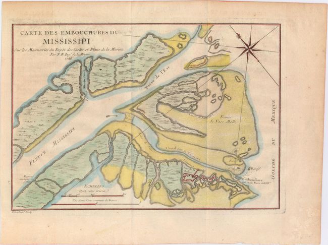
"Carte des Embouchures du Mississipi sur les Manuscrits du Depot des Cartes et Plans de la Marine", Bellin, Jacques Nicolas
Subject: Colonial Louisiana, Mississippi River
Period: 1744 (dated)
Publication: Histoire et Description de la Nouvelle France
Color: Hand Color
Size:
11.2 x 7.8 inches
28.4 x 19.8 cm
This chart details the Mississippi River Delta as the river empties into the Gulf of Mexico. The map is oriented by a fleur-de-lys with north to the upper left. Fort Balise is shown on a small island at the mouth of the Southeast Pass. Engraved by Dheulland. Jacques Nicolas Bellin had a distinguished 50-year career as one of France’s leading cartographers. He was the lead hydrographer to the French Navy upon the creation of France's hydrographic office, a member of the Academie de Marine and of the Royal Society of London. His maps of the French possessions in North America are particularly important.
References:
Condition: A
Issued folding on watermarked paper with some minor printer's ink residue and toning along sheet edges.