"[Lot of 2] Military Map of the Peninsula of Florida South of Tampa Bay... [and] Map of a Portion of the State of Florida Showing Drainage District", U.S. Government
Subject: Southern Florida
Period: 1911 (circa)
Publication: Sen Doc. No. 89, 62nd Cong, 1st Sess.
Color: Black & White
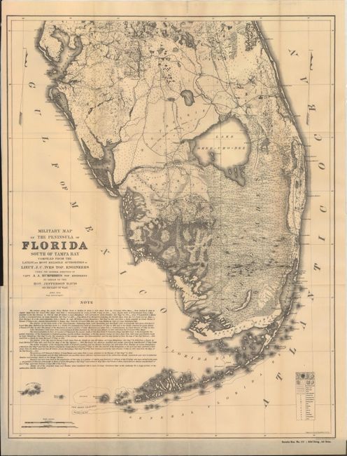
A. Military Map of the Peninsula of Florida South of Tampa Bay..., by Lt. Joseph C. Ives (16.5 x 21.3"). This is a rare reprint of the 1856 map covering the southern portion of Florida. Issued under the direction of Jefferson Davis, this highly detailed map depicts swamps, marshes, sawgrass, scrubs and prairie land. In addition to the vegetation, the map shows towns and villages, forts, wagon roads and trails with an extensive note below the image. Condition: Issued folding with attractive even-age toning and a few tiny splits at fold intersections.
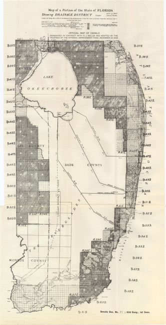
B. Map of a Portion of the State of Florida Showing Drainage District (10.5 x 22.0"). A detailed map of the region from Lake Okeechobee to the southern tip of the state showing six different drainage districts and the system of canals that drain from the lake into the Atlantic Ocean and Gulf of Mexico. Published in the same report as the above map. Condition: Issued folding with a binding trim at left and a tiny associated binding tear that has been closed on verso with archival tape.
References:
Condition: A
See descriptions above.