"[2 Maps with Report] Map Showing the Atchison, Topeka and Santa Fe Railroad System [and] Map Showing the Atchison and Its Auxiliary Roads in the State of Kansas [and] Annual Report of the Board of Directors of the Atchison, Topeka and Santa Fe…",
Subject: Western United States, Railroads
Period: 1885 (published)
Publication:
Color: Printed Color
Size:
5.8 x 9 inches
14.7 x 22.9 cm
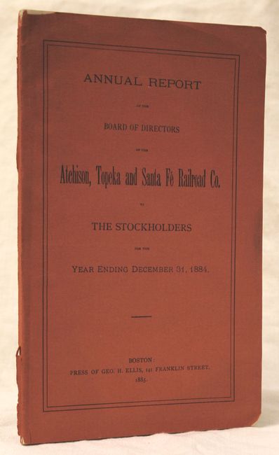
This lot includes the company's annual report detailing its financial condition and operations for the year 1885 as well as the following separated maps:
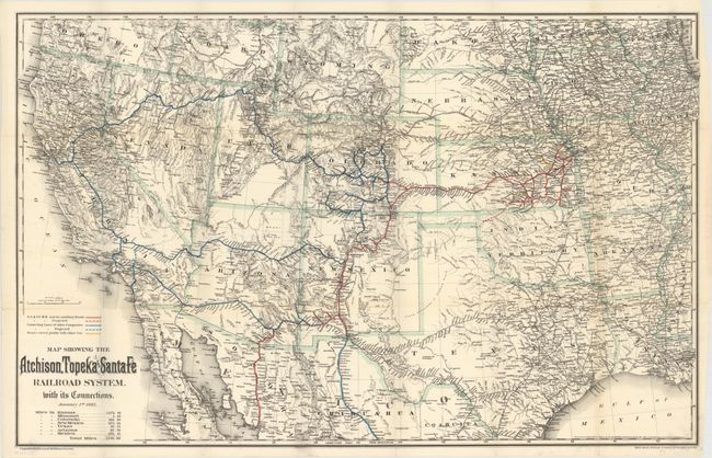
A. Map Showing the Atchison, Topeka and Santa Fe Railroad System. With Its Connections (32.8 x 20.9"). This railroad map provides excellent detail of the area west of the Mississippi River. It delineates the major rail lines of the Atchison, Topeka & Santa Fe, branch lines, and lines owned by other companies via colorful overprinting. The map also shows good detail of towns, cities, rivers and topography. A table at bottom indicates the company owns nearly 2,800 miles of track. Condition: A clean and bright example issued folding with several fold separations closed on verso with archival tape.
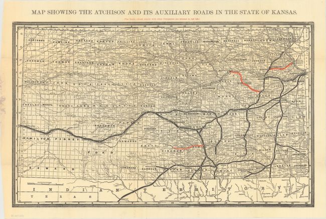
B. Map Showing the Atchison and Its Auxiliary Roads in the State of Kansas (22.3 x 13.7"). This map is focused on the track in Kansas, with lines spreading from Kansas City, Atchison and Topeka westward. Railroads in black are company owned, while the shorter lines in red are jointly owned with other companies. Condition: Issued folding with just a few tiny splits at fold intersections closed on verso with archival tape.
51 pp. Slim octavo with salmon colored wrappers and title on front cover.
References:
Condition: B+
Report is very good with just a few chips along the edge of a few sheets and the back cover. See description above for the condition of the maps.