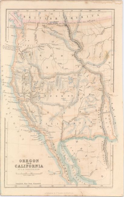
"Oregon and California", Swanston, George H.
Subject: Western United States
Period: 1850 (published)
Publication: Gazetteer of the World
Color: Hand Color
Size:
6.1 x 9.1 inches
15.5 x 23.1 cm
This terrific western map from the era of the California Gold Rush covers roughly the same area as J.C. Fremont's celebrated map of the west. The map extends as far east as Santa Fe and includes many towns and cities, rivers, lakes, and mountains. It features a large Oregon Territory which stretches to the Continental Divide and north to the border with Canada. A note at the border reads, "Boundary Line between Great Britain and United States as settled June 15th 1846." Another note runs along the U.S.-Mexico border, dating its establishment in 1848. Pyramid Lake and the Timpanogos or Gt. Salt L. are located, but there is no sign of Bigler Lake or Lake Tahoe. There is not a direct mention of gold mining activities but the important ore bearing rivers are shown and named. Published by A. Fullarton & Co.
References: Wheat (TMW) #693.
Condition: B+
Light scattered foxing with a small damp stain confined to the top blank margin.