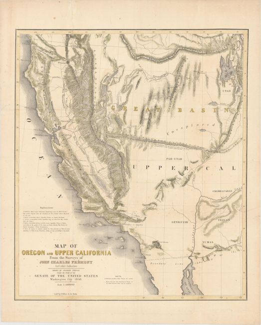
"Map of Oregon and Upper California from the Surveys of John Charles Fremont and Other Authorities", Fremont/Preuss
Subject: Western United States
Period: 1848 (dated)
Publication: HR Doc. #17, 31st Congress
Color: Hand Color
Size:
16.9 x 19.6 inches
42.9 x 49.8 cm
This is the smaller version of Fremont's highly respected map of the American West. It was published by Congress in 1850 to meet the demand for information concerning the California Gold Rush. The map covers a smaller area than his larger map of the same title, eliminating Oregon and covering California and only the western parts of present-day Arizona and Utah. The El Dorado or Gold Regions are shown on the south fork of the American River and the upper course of the Feather River. It contains Fremont's famous topographical error, showing an east-west mountain range across the unexplored area of the Great Basin. The map was "Drawn by Charles Preuss Under the Oder to the Senate of the United States, Washington City 1848." Lithography by the Baltimore firm of E. Weber & Co.
References: Wheat (TMW) #613; Wagner Camp #150; Wheat (Gold) #58.
Condition: B+
Issued folding, now pressed and backed in Japanese tissue to repair fold separations. There are tiny spots of foxing, primarily in bottom half of map.