Catalog Archive
Auction 149, Lot 185

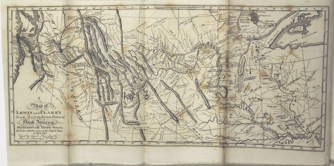
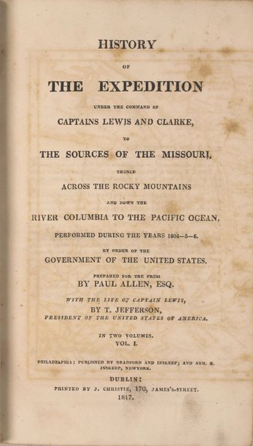
Reduced Version of Lewis & Clark's Famous Map

"A Map of Lewis and Clark's Track, Across the Western Portion of North America from the Mississippi to the Pacific Ocean... [with] History of the Expedition Under the Command of Captains Lewis and Clarke, to the Sources of the Missouri…[Vol 1 Only]", Lewis & Clark

Subject: Western United States

Period: 1817 (published)

Publication:

Color: Black & White

Size:
13.7 x 6.1 inches
34.8 x 15.5 cm
Download High Resolution Image
(or just click on image to launch the Zoom viewer)

This is the reduced Dublin edition of this landmark map. Printed in 1817, it follows the full-sized editions printed in Philadelphia and London. The map is widely considered to be one of the most important maps in United States history. According to Wheat, "This 1814 map was the progenitor of many later maps, and one of the most influential ever drawn, its imprint still to be seen on maps of Western America." He continues, "This was a great map, a milestone of mapping in its time, and countless place names it gave to the face of America remain today as an ineradicable cultural heritage."

The map itself marks the culmination of a 28-month journey in which Meriwether Lewis and William Clark would finally dispel the notion of a Northwest Passage. Before their discoveries, it was widely believed that the headwaters of the Missouri River and Columbia River were very close to one another geographically, and that the only obstacle to creating a canal or portage was a plateau or gentle hill. Instead, Lewis and Clark discovered a series of rugged mountains dividing the two rivers. Additionally, they found that the waters off the western slopes of the Rockies were not navigable, compounding the problem. As a result of their expedition, the myth of the great Northwest Passage was finally put to rest, and the discoveries of Lewis and Clark would shape the next generation of cartographers and their maps of the western United States.

The map is still bound into volume 1 (588 pp.) and includes 3 additional engraved plates (two plans and one view). This edition contains some unique aspects not found in the other early Biddle-Allen editions, including the folding general map at slightly greater than half original size, a 22-page biography entitled "Life of Captain Lewis" by Thomas Jefferson, and view plate "Principal Cascade of the Missouri River." Furthermore, Wagner-Camp remarked, "This reissue of the Bradford and Innskeep edition of 1814 was printed with larger, clearer type, thirty-two lines to the page instead of the earlier thirty-six, and contained other editorial changes." Eliot Coues considered this to be the best of the early editions.

Octavo, hardbound in original quarter calf with tips over marbled boards. Printed by J. Christie, 170, Jame's-Street. Volume 1 only.

References: cf. Wheat (TMW) #316; Wagner-Camp 13:6; Howes L317.

Condition: B

A nice dark impression with scattered foxing and toning along one fold. Text is mostly clean and tight with just an occasional spot of foxing. The front cover is nearly separated, back hinge is starting, and the spine has some minor cracking and small chips at top and bottom. Covers show average wear with bumped corners.

Estimate: $6,500 - $8,000

Sold for: $7,500

Closed on 5/21/2014

Archived