Catalog Archive
Auction 149, Lot 103

"Parte Orientale del Canada, Nuova Scozia Settentrionale, e Parte di Labrador", Zatta, Antonio

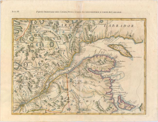
Subject: Eastern Canada

Period: 1779 (circa)

Publication: Atlante Novissimo...

Color: Hand Color

Size:
16.9 x 12.9 inches
42.9 x 32.8 cm
Download High Resolution Image
(or just click on image to launch the Zoom viewer)

This map is one sheet of the Italian version of Mitchell's seminal map of the British Dominions in North America that Zatta issued in 12 sections with the whole titled "Le Colonie Unite dell' America Settentrle." The map covers part of New Brunswick, Anticosti Island and the St. Lawrence River, and depicts the navigational route from the Gulf of St. Lawrence to Quebec.

References: Kershaw #1012.

Condition: B+

Watermarked paper with a hint of toning along centerfold and minor soiling.

Estimate: $275 - $350

Unsold

Closed on 5/21/2014

Archived