Catalog Archive
Auction 148, Lot 71

"L'Amerique Divisee par Grands Etats", Janvier/Lattre

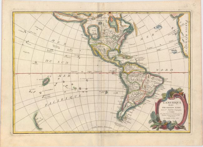
Subject: Western Hemisphere

Period: 1762 (dated)

Publication: Atlas Moderne

Color: Hand Color

Size:
17.6 x 12 inches
44.7 x 30.5 cm
Download High Resolution Image
(or just click on image to launch the Zoom viewer)

A fine map of the Americas that features a huge, imaginary Sea of the West and hints of a possible Northwest Passage. Alaska is shown in an early configuration with a rough shape incorporating the Aleutians and notations concerning the coastline discoveries in 1741 by the Russians. In North America, the British colonies are shown east of the mountains, French Louisiana takes in most of the interior and Spain controls Florida, New Mexico and Mexico. There are several islands shown in the Pacific and just the western coastline of New Zealand. A handsome map with a decorative rococo-style title cartouche.

References: McGuirk #108.

Condition: B+

A nice impression on watermarked paper with light toning along the centerfold.

Estimate: $240 - $300

Sold for: $210

Closed on 2/19/2014

Archived