Catalog Archive
Auction 148, Lot 676

"[Japanese Pocket Map - Osaka, Japan]", Anon.

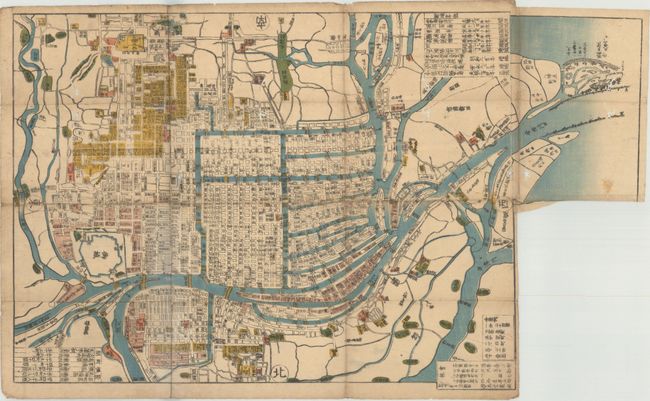
Subject: Osaka, Japan

Period: 1847 (circa)

Publication:

Color: Hand Color

Size:
20.3 x 15 inches
51.6 x 38.1 cm
Download High Resolution Image
(or just click on image to launch the Zoom viewer)

This late Edo period map depicts the city of Osaka on the southern part of Japan's main island of Honshu. The map clearly displays streets, extensive waterways, city blocks and individual buildings including Osaka Castle. There is an unusual 5 x 8" extension at right which shows the mouth of the Yodo River as it enters Osaka Bay (with the extension, the dimensions would measure 25.3 x 15.0"). North is oriented to the bottom.

References:

Condition: B

Issued folding with a number of worm tracks and a short split at a fold intersection resulting in some small loss of image.

Estimate: $350 - $450

Sold for: $250

Closed on 2/19/2014

Archived