Catalog Archive
Auction 148, Lot 659

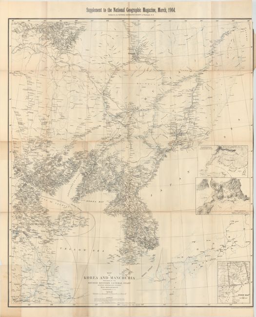
"Map of Korea and Manchuria Prepared by the Second Division, General Staff (Military Information Division)...", U.S. War Department

Subject: Eastern Asia

Period: 1904 (dated)

Publication:

Color: Printed Color

Size:
33.8 x 39.3 inches
85.9 x 99.8 cm
Download High Resolution Image
(or just click on image to launch the Zoom viewer)

This large, highly detailed map covers the scene of the conflict during the Russo-Japanese war, which was considered the first major war of the 20th century. It is filled with hundreds of place names, roads and communication cables on both land and sea. Includes insets of Port Arthur and Vladivostok with an index map at bottom. Prepared by the War Department and published as a supplement to the March 1904 issue of the National Geographic Magazine, shortly after the conflict broke out.

References:

Condition: B

Issued folding with a narrow right margin, several small splits at fold intersections, and some occasional light toning.

Estimate: $100 - $130

Sold for: $170

Closed on 2/19/2014

Archived