Catalog Archive
Auction 148, Lot 647

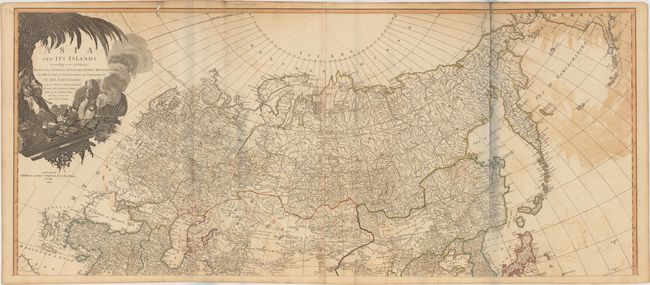
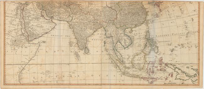
"[On 2 Sheets] Asia and Its Islands According to d'Anville: Divided into Empires, Kingdoms, States, Regions, with The European Possessions and Settlements in the East Indies…", Laurie & Whittle

Subject: Asia

Period: 1794 (dated)

Publication: A New Universal Atlas…

Color: Hand Color

Size:
46.8 x 20.2 inches
118.9 x 51.3 cm
Download High Resolution Image
(or just click on image to launch the Zoom viewer)

A superb, large-scale map based on the cartography of the famous French cartographer Jean Baptiste Bourguignon d' Anville. It provides an extremely detailed view of the continent and extends to include all of South East Asia and numerous islands of the Pacific, with emphasis on English exploration. The discoveries of Capt. Cook appear in the Aleutian Islands (Foxes Islands) and the Northeast coast of Asia. Hokkaido is featured as an archipelago named Isles of Yeso, including the Three Sisters. The Carolines are accurately depicted on an east-west axis. The large decorative cartouche features an Asian merchant, his exotic goods, and a camel. If joined together, the map would measure 46.8 x 40.4".

References:

Condition: C+

Issued on watermarked paper with moderate offsetting, brown stains, a 6-7" clean fold separation on each sheet, and two small holes along the top border.

Estimate: $1,200 - $1,500

Sold for: $600

Closed on 2/19/2014

Archived