Catalog Archive
Auction 148, Lot 544

"Alpina seu Foederatae Rhaetiae Subditarumque ei Terrarum Nova Descriptio", Blaeu, Willem

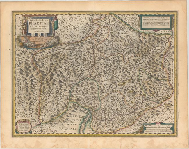
Subject: Eastern Switzerland

Period: 1643 (published)

Publication: Theatre du Monde ou Nouvel Atlas

Color: Hand Color

Size:
19.7 x 14.9 inches
50 x 37.8 cm
Download High Resolution Image
(or just click on image to launch the Zoom viewer)

Handsome map of eastern Switzerland and northern Italy around Lake Como. The region is known as Graubunden, which was once part of a Roman province called Raetia. The map highlights the fortifications along the Adda River, as well as provides excellent information on the topography, cities and tiny villages throughout the region. Each corner of the map is adorned with a decorative cartouche. The title cartouche credits Philip Cluver and features a soldier and river gods, and the cartouche at top right dedicates the map to Hadrianus Pauw. Engraved by Evert Symonsz van Hamersveldt. French text on verso.

References: Van der Krogt (Vol. II) #4940:2.2.

Condition: A

A nice impression with old color that has been lightly refreshed and damp stains in bottom blank margin that just touch neatline in a few spots.

Estimate: $300 - $400

Sold for: $210

Closed on 2/19/2014

Archived