Catalog Archive
Auction 148, Lot 485

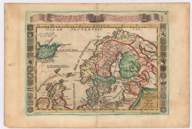
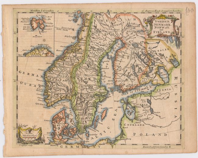
"[Lot of 2] La Scandinavie ou les Royaumes de Danemark de Norvege de Suede et Laponie... [and] Sweden, Denmark, Norway, and Finland",

Subject: Scandinavia

Period: 1745-50 (circa)

Publication:

Color: Hand Color

Size:
See Description
Download High Resolution Image
(or just click on image to launch the Zoom viewer)

A pair of well-engraved eighteenth century maps of Scandinavia.

A. La Scandinavie ou les Royaumes de Danemark de Norvege de Suede et Laponie..., by Elias Baeck, circa 1745 (8.8 x 5.5"). Although it lacks topographical detail, this small map of the region is flanked by columns of coats-of-arms and has a banner running over top of it providing coordinates in German and French. The map also extends to show parts of the United Kingdom and Iceland. Condition: Some color offsetting, minor soiling, and marginal toning.

B. Sweden, Denmark, Norway, and Finland, by Thomas Jefferys, circa 1750 (9.1 x 7.4"). Filled with details of towns, political boundaries, rivers, and topography, this map includes an elaborate title cartouche, a distance scale enclosed in a drape style cartouche, and an inset showing Svalbard. Condition: Issued folding, now flat, with some minor toning on the left side of the image and a spot in an unengraved area within the inset.

References:

Condition: B

See description above.

Estimate: $100 - $140

Sold for: $75

Closed on 2/19/2014

Archived