Catalog Archive
Auction 148, Lot 47

"Emisfero Terrestre Settentrionale Tagliato su l'Equatore", Zatta, Antonio
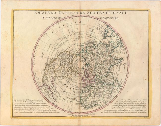
Subject: North Pole

Period: 1779 (dated)

Publication: Atlante Novissimo…

Color: Hand Color

Size:
16.5 x 13 inches
41.9 x 33 cm
Download High Resolution Image
(or just click on image to launch the Zoom viewer)

Based on Robert de Vaugondy's map, this polar projection covers from the North Pole to the equator. In North America, the mythical Northwest Passage is shown connecting through the Strait of Anian and L. de Fonte to Hudson Bay. The map also includes Lahontan’s system of rivers and lakes in the west; it labels the river connecting the Mississippi River to the Pacific the Beautiful River. The Arctic discoveries of the eighteenth century are all well depicted.

References:

Condition: B+

Original color on watermarked paper with light toning along the centerfold and a few tiny spots of foxing.

Estimate: $250 - $325

Sold for: $135

Closed on 2/19/2014

Archived