Catalog Archive
Auction 148, Lot 469

"Anglia Regnum", Mercator/Hondius

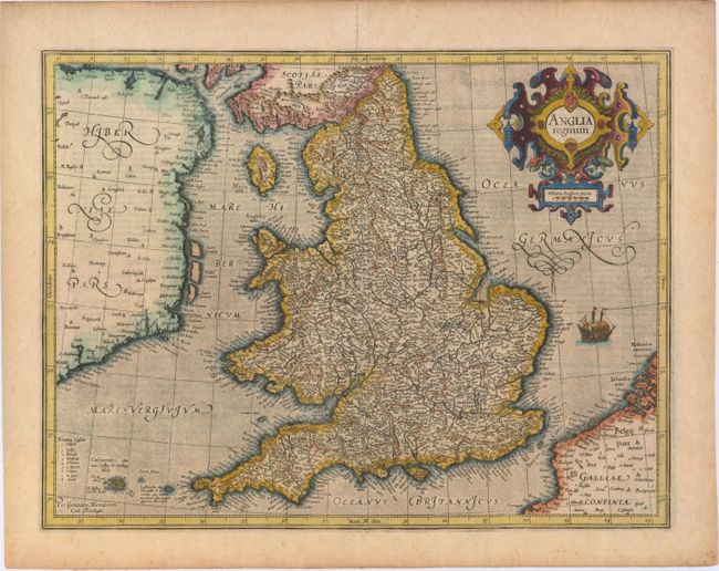
Subject: England & Wales

Period: 1595 (circa)

Publication: Gerard Mercatoris Atlas

Color: Hand Color

Size:
18.1 x 13.8 inches
46 x 35.1 cm
Download High Resolution Image
(or just click on image to launch the Zoom viewer)

This attractive map of Elizabethan England is filled with names taken from Saxton's map of 1579. County boundaries and the Latinized names of counties are shown. The map is beautifully engraved in Mercator's characteristic style featuring a stipple engraved sea with a sailing ship, bold calligraphy and a handsome title cartouche. Latin text on verso, published between 1595-1602.

References: Shirley (BI to 1650) #181; Van der Krogt #5100:1A.1.

Condition: B+

An early impression on watermarked paper with a few small spots and a centerfold separation that enters 3" into map at top and has been repaired with old paper on verso.

Estimate: $600 - $750

Sold for: $450

Closed on 2/19/2014

Archived