Catalog Archive
Auction 148, Lot 394

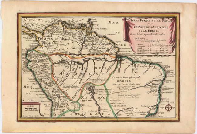
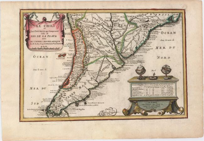
"[Lot of 2] La Terre Ferme et le Perou avec le Pays des Amazones et le Bresil dans l'Amerique Meridionale [and] Le Chili et les Provinces qui Composent Celle de Rio de la Plata avec les Terres Magellanique", Fer, Nicolas de

Subject: South America

Period: 1705 (dated)

Publication: L'Atlas Curieux ou le Monde

Color: Hand Color

Size:
13.5 x 9.1 inches
34.3 x 23.1 cm
Download High Resolution Image
(or just click on image to launch the Zoom viewer)

This pair of maps combine to create a map of the continent, although each map stands on its own with full borders and a drape-style cartouche. Both maps were finely engraved by Charles Inselin. Size varies slightly.

The northern map gives great detail of the Amazon River and its tributaries. Possible connections between the Paraguay River and the Amazon or Sao Francisco Rivers are depicted. Numerous towns are identified, primarily along the coasts, with several notations throughout the map. On the southern map, detail is again mostly confined along the coastlines, but there are some inland features including rivers, lakes, marshes and the locations of missions. The Andes are noted as a vast volcanic cordillera. A table of longitudes and latitudes of key cities and the publisher's imprint are presented on a large chest, which is also supporting a globe, compass and armillary sphere.

References: Pastoureau, FER I [113-114].

Condition: A

Nice impressions on watermarked paper with one small, professionally repaired hole in the Atlantic Ocean on the southern map and light printer's ink residue.

Estimate: $300 - $400

Sold for: $220

Closed on 2/19/2014

Archived