Catalog Archive
Auction 148, Lot 389

"A New and Exact Map of the Island of Antigua in America, According to an Actual and Accurate Survey, with the Different Parishes, the Churches, Divisions, Boundaries; and a Plan of English Harbour", Bew, John
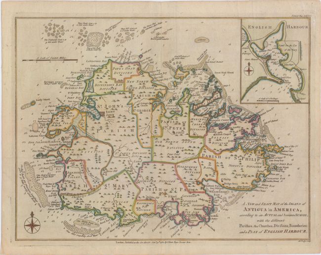
Subject: Antigua

Period: 1782 (dated)

Publication: Political Magazine

Color: Hand Color

Size:
14.5 x 11 inches
36.8 x 27.9 cm
Download High Resolution Image
(or just click on image to launch the Zoom viewer)

This attractive small map of Antigua was reduced from Robert Baker's large survey of the island. The divisions and parishes are noted and there is a considerable amount of interior detail provided including the locations of churches. The coastal soundings and hazards are meticulously identified, with excellent notes of submerged rocks and other hidden dangers. A plan of English Harbour is included in an inset map.

References: Jolly #POL-44.

Condition: A

Issued folding, now pressed, on watermarked paper with a hint of offsetting and light tissue reinforcing the folds on verso.

Estimate: $300 - $400

Sold for: $180

Closed on 2/19/2014

Archived