Catalog Archive
Auction 148, Lot 328

"The Cornucopia Map of Norfolk and Vicinity",

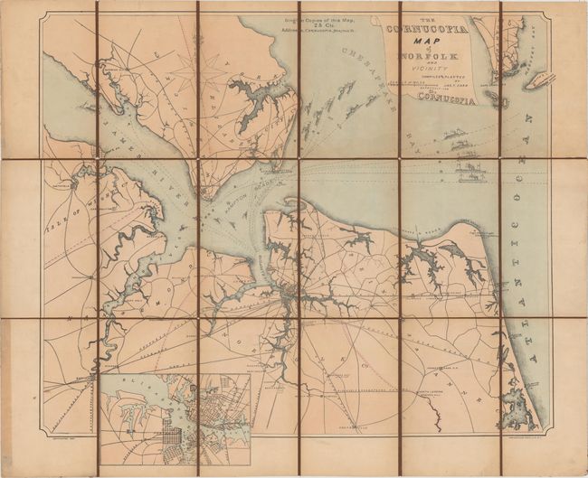
Subject: Norfolk, Virginia

Period: 1887 (dated)

Publication:

Color: Hand Color

Size:
27.5 x 24.5 inches
69.9 x 62.2 cm
Download High Resolution Image
(or just click on image to launch the Zoom viewer)

This map of the Tidewater region of Virginia covers the area from Smithfield and Suffolk east to Norfolk and Cape Henry. Several existing and proposed railroads are depicted as well as the Albemarle Chesapeake Canal, which was built in 1860 to link the Albemarle Sound to the Chesapeake Bay. The map is decorated by a series of 21 boats and ships departing from the area along with a detailed inset of the Norfolk/Portsmouth area. Lithographed by Endicott & Co.

References:

Condition: B+

Dissected and mounted on linen with some faint damp stains below the title.

Estimate: $250 - $325

Sold for: $180

Closed on 2/19/2014

Archived