Catalog Archive
Auction 148, Lot 286
"A Plan of New York Island, Part of Long Island &c. Shewing the Position of the American & British Armies, Before, At, and After the Engagement on the Heights Aug. 27th 1776", Phillips, Richard (Sir)
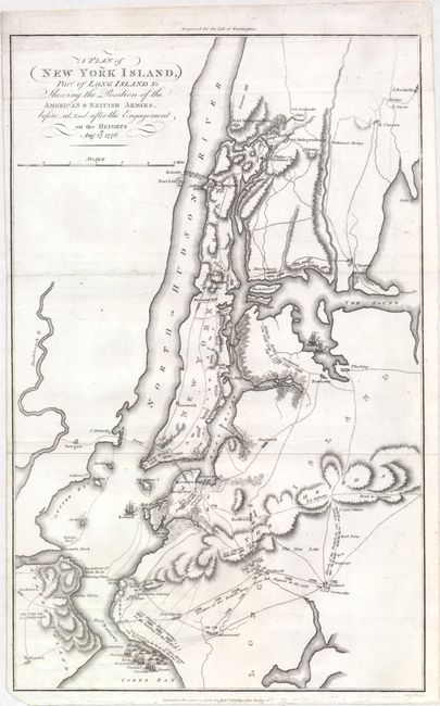
Subject: New York, Revolutionary War
Period: 1806 (dated)
Publication: Marshall's Life of Washington
Color: Black & White
Size:
10.1 x 16.1 inches
25.7 x 40.9 cm
Download High Resolution Image
(or just click on image to launch the Zoom viewer)
(or just click on image to launch the Zoom viewer)