Catalog Archive
Auction 148, Lot 266

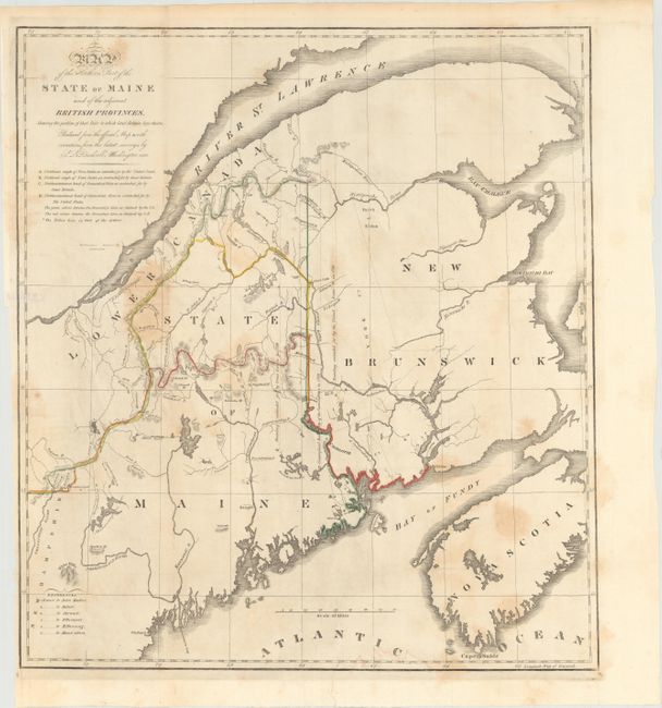
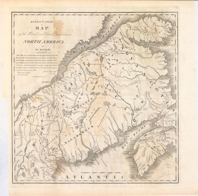
"[Lot of 2] Map of the Northern Part of the State of Maine and the Adjacent British Provinces… [and] Extract from a Map of the British and French Dominions in the North America by Jn O. Mitchell", U.S. Government

Subject: Maine

Period: 1838 (published)

Publication: Sen. Doc. 502, 25th Cong., 2nd Sess.

Color:

Size:
16.5 x 15.3 inches
41.9 x 38.9 cm
Download High Resolution Image
(or just click on image to launch the Zoom viewer)

The first map details the boundary dispute between the United States and Great Britain relating to Maine. Hand coloring is used to show the boundary as claimed by the United States and by Great Britain, with a third line labeled "that of the Arbiter" which closely corresponds to Maine's present-day border with Canada. A table gives the major points of contention in this border dispute. Another table names land grants belonging to six land holders. The second map (13.3 x 13") was included in the same Senate report for historical purposes. It was extracted from Mitchell's map of 1755 by W.J. Stone.

References: Claussen & Friis #219 & #220; Phillips (M) p. 384.

Condition: B

Issued folding with some light stains in the image and binding trims at left.

Estimate: $200 - $250

Sold for: $100

Closed on 2/19/2014

Archived