Catalog Archive
Auction 148, Lot 247

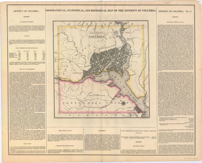
"Geographical, Statistical, and Historical Map of the District of Columbia", Carey & Lea
Subject: Washington, D.C.

Period: 1822 (circa)

Publication: A Complete Historical, Chronological, And Geographical American Atlas

Color: Hand Color

Size:
10.5 x 10.8 inches
26.7 x 27.4 cm
Download High Resolution Image
(or just click on image to launch the Zoom viewer)

This map of the nation's capital is on a full folio sheet (20.6 x 16.6") with surrounding text describing boundaries, climate, population, nearby towns, commerce, government, and history. Washington, Alexandria, and Georgetown are shown as plans, and several waterways and roads are identified. A compass rose capped with a fleur-de-lis indicates that the north is oriented to the upper left and an arrow indicates the direction of the Potomac River. Engraved by Young and Delleker.

References: Phillips (DC) PW #84.

Condition: A

Original outline color with centerfold separations at top and bottom that do not enter the map image and have been closed on verso with archival tape.

Estimate: $350 - $425

Sold for: $250

Closed on 2/19/2014

Archived