Catalog Archive
Auction 148, Lot 196

"A New and Accurate Map of North Carolina, and Part of South Carolina, with the Field of Battle between Earl Cornwallis and General Gates", Lodge, John

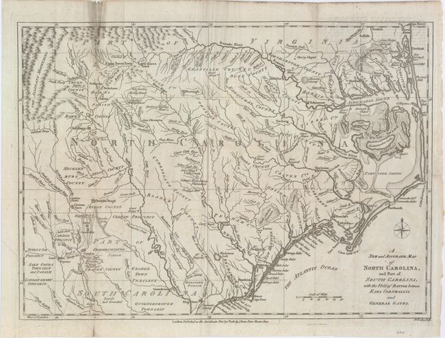
Subject: Colonia Southeast United States

Period: 1780 (dated)

Publication: Political Magazine

Color: Black & White

Size:
15 x 10.8 inches
38.1 x 27.4 cm
Download High Resolution Image
(or just click on image to launch the Zoom viewer)

This scarce map of the Carolinas, published during the American Revolution, is apparently based on Henry Mouzon's 1778 foundation map of the region. It is filled with topographical notes and the locations of important plantations, court houses, meeting houses, swamps, and chapels. This map illustrates the region involved in the southern theater of the war. After General Clinton seized Charleston in May of 1780, the British began a campaign into the Carolinas in pursuit of the remnants of the Continental Army. The map illustrates the Battle of Camden in August, 1780, where the American General Gates was defeated by British General Cornwallis. Includes two pages of related text describing the conflict.

References: Jolly #POL-16.

Condition: B+

Issued folding and now flattened with faint offsetting and light soiling along a professionally repaired fold separation that enters 1" into map at top. There are a few tiny holes at fold intersections, only visible when held to light.

Estimate: $600 - $700

Sold for: $400

Closed on 2/19/2014

Archived