Catalog Archive
Auction 148, Lot 175

"New England New York New Jersey and Pensilvania", Salmon, Thomas

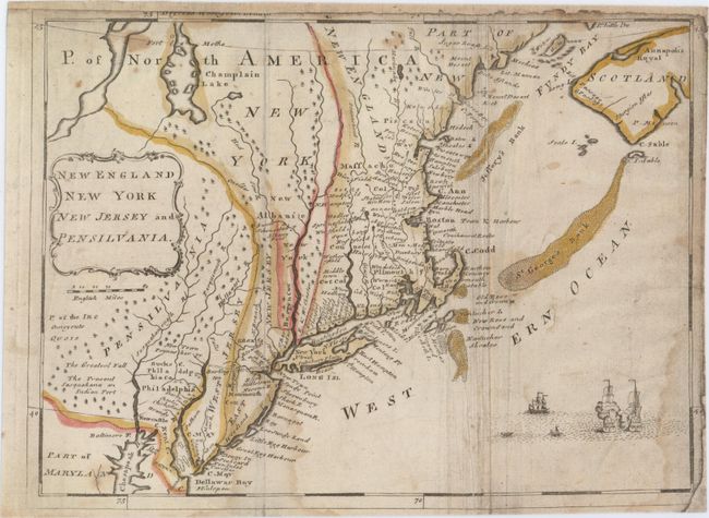
Subject: Colonial New England & Mid-Atlantic United States

Period: 1767 (circa)

Publication: New Geographical and Historical Grammar

Color: Hand Color

Size:
10.5 x 7.7 inches
26.7 x 19.6 cm
Download High Resolution Image
(or just click on image to launch the Zoom viewer)

This fascinating map was copied from Moll's map of the same name, one of the earliest Post Road maps. As in the Moll map, the postal road is shown extending from Portsmouth, New Hampshire along the coast to New York and turning west to the Delaware River. New York is confined to a narrow strip along the Hudson River and New Jersey is divided into West and East New Jersey. Several Indian tribes are noted in Pennsylvania. Nova Scotia is named Scotland. A sea battle rages in the Atlantic.

References: McCorkle #767.2.

Condition: B

Issued folding, now flattened, with light creasing along the folds. Remargined at top and at right with the majority of the neatline missing. Faint damp stains enter image at bottom and at right, and there are several smaller light stains scattered throughout the image.

Estimate: $300 - $375

Sold for: $275

Closed on 2/19/2014

Archived