Catalog Archive
Auction 147, Lot 584

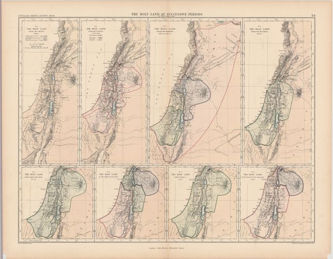
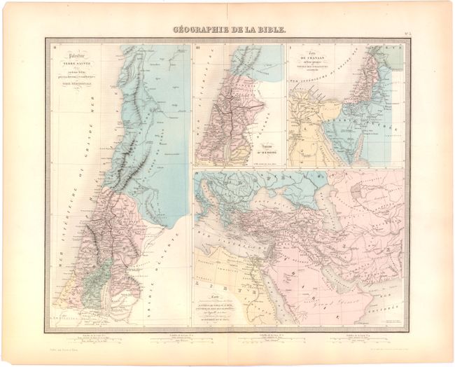
"[Lot of 2] The Holy Land at Successive Periods on the Same Scale [and] Geographie de la Bible",

Subject: Holy Land

Period: 1850-70 (circa)

Publication:

Color:

Size:
See Description
Download High Resolution Image
(or just click on image to launch the Zoom viewer)

A. The Holy Land at Successive Periods on the Same Scale, by William Smith, from Dr. William Smith's Ancient Atlas, circa 1870, printed color (22.7 x 17.1"). Eight maps on one sheet showing the shifting political divisions of the Holy Land at different periods in time. The maps cover from 1451 B.C. to A.D. 70, starting with the Holy Land "before the conquest," and ending with the destruction of Jerusalem. Condition: Light toning along centerfold with a tiny surface tear at top center and centerfold separations at top and bottom that have been closed on verso with archival tape. (B+) B. Geographie de la Bible, by Alexander Vuillemin, circa 1850, hand color (16.7 x 13.5"). Four maps on one sheet showing the geography of different areas as mentioned in the Bible. The maps cover Palestine, the Herodian kingdom, and Canaan, and one depicts the travels of the Apostles Peter and Paul in the eastern Mediterranean and Holy Land. Engraved by Lemercier. Condition: A hint of offsetting and light toning along sheet edges. (A)

References:

Condition:

See description above.

Estimate: $100 - $130

Sold for: $75

Closed on 11/20/2013

Archived