Catalog Archive
Auction 146, Lot 77

"[Untitled - Magic Lantern Slide of Yellowstone]",

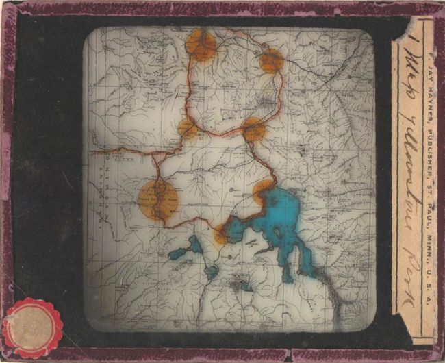
Subject: Cartographic Miscellany, Yellowstone

Period: 1890 (circa)

Publication:

Color: Hand Color

Size:
3.2 x 4 inches
8.1 x 10.2 cm
Download High Resolution Image
(or just click on image to launch the Zoom viewer)

This unusual little map of Yellowstone National Park is encased in glass and was meant for use in a "Magic Lantern". These devices were first developed in the mid 17th century by Christiaan Huygens and their use continued well into the early 20th century. The lanterns used a concave mirror and light source to project the images onto a screen or wall (an early slide proejctor).

This specific slide was published by Frank Jay Haynes, who was the official photographer for both Yellowstone National Park and the Northern Pacific Railway. The tiny map shows lakes, rivers, numerous mountain peaks and highlights in orange Mammoth Hot Springs, Norris Geyser Basin and the Firehole Geysor Region to name a few. A very unique cartographic find.

References:

Condition: B+

Viewing image is very good with some light wear along the edges of the plate. Paper label at right has two small chips in the bottom corners.

Estimate: $240 - $300

Sold for: $120

Closed on 9/4/2013

Archived