Catalog Archive
Auction 146, Lot 773

A Rare Pre-Cook Map Focusing on Australia

"Ins Kleine Gebrachte Karte von den Sud-Laendern Zur Histoire der Reisen...", Bellin, Jacques Nicolas
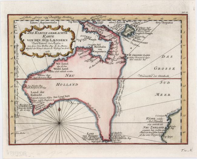
Subject: Australia

Period: 1753 (dated)

Publication:

Color: Hand Color

Size:
10.9 x 7.9 inches
27.7 x 20.1 cm
Download High Resolution Image
(or just click on image to launch the Zoom viewer)

This is one of the few 18th century maps to focus on the Australian continent prior to Cook's famous first voyage from 1768-1771. Mainland Australia is connected to both Tasmania (Land Van Diemen) and Papua New Guinea (Neu Guinea). Along the imaginary eastern coastline is a note that translates as: "I suppose that the land of Diemen can join with the land of the Holy Ghost, but this is without proof." A partial coastline of New Zealand is shown peeking out of the corner of the map, with a note that it was discovered by Abel Tasmand in 1642 and speculation that it might be part of a great southern continent. This is an important map of Australia depicting the interesting theories made prior to exploration of the region later in the century. This example is from a German edition of Prevost's Histoire Generale des Voyages.

References: cf. Tooley (Australia) p. 24, #156 (French edition).

Condition: A

A nice impression on a clean, bright sheet with light printer's ink residue.

Estimate: $800 - $1,000

Sold for: $2,000

Closed on 9/4/2013

Archived