Catalog Archive
Auction 146, Lot 709

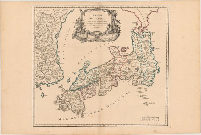
"L'Empire du Japon, Divise en Sept Principales Parties, et Subdivise en Soixante et Six Royaumes", Robert de Vaugondy, Gilles

Subject: Japan & Korea

Period: 1750 (dated)

Publication: Atlas Universel

Color: Hand Color

Size:
21.1 x 18.9 inches
53.6 x 48 cm
Download High Resolution Image
(or just click on image to launch the Zoom viewer)

Large, finely engraved map of Japan with a distinctively French style title cartouche containing two small landscapes. The map draws heavily on the previous work of Bellin, but includes a number of improvements to Terre d'Yedso (Hokkaido) similar to the manuscripts of Engelbert Kaempfer. The fictitious island of Matsumae is removed and now Matsaki is shown as a part of Yedso. The provinces are clearly outlined and there are many place names. The eastern part of the Korean peninsula is also shown with a good amount of detail. The sea between Korea and Japan is named both the Mer de Coree and the Mer du Japon reflecting a compromise to the long-standing dispute over the name of this sea. This great map was to influence the cartography of Japan into the 19th century. This is the first state, published in 1757 as part of the first edition.

References: Walter #86, OAG #100; Pedley #410.

Condition: B+

Fine original outline color, a sharp impression, and wide original margins with a bit of faint toning on centerfold and a professionally repaired fold separation.

Estimate: $800 - $950

Sold for: $550

Closed on 9/4/2013

Archived