Catalog Archive
Auction 146, Lot 647

"Chorographica Terrae Sanctae Descriptio", Hollar, Wenceslaus
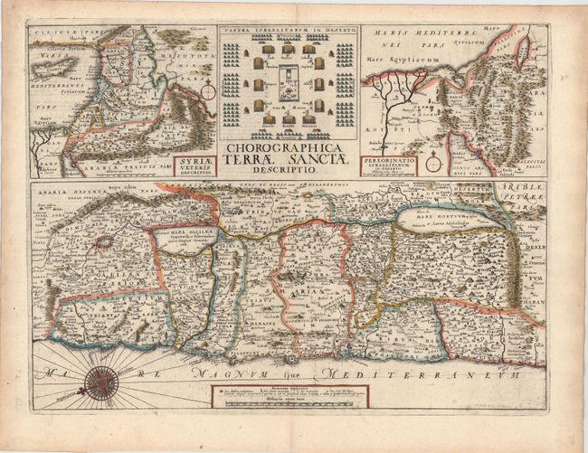
Subject: Holy Land

Period: 1657 (dated)

Publication: Biblia Sacra Polyglotta…

Color: Hand Color

Size:
19.4 x 14.7 inches
49.3 x 37.3 cm
Download High Resolution Image
(or just click on image to launch the Zoom viewer)

This sheet includes three maps of the Holy Land and a plan of the encampment of the Israelites in the desert. The large map at the bottom of the sheet depicts Palestine on both sides of the Jordan, divided into the 12 Tribes. At top left is the Holy Land along with part of the eastern Mediterranean, extending to include Cyprus. The map at top right focuses on the area between the Nile Delta and the Dead Sea, illustrating the Exodus. The three maps are based on similar ones by Philippe Briet. Latin text on verso.

Wenceslaus Hollar (1607-1677) was an engraver, born in Prague, best known for his city views. Merian trained him in engraving in his workshop in Frankfurt, and Hollar later moved to London, where he died in poverty despite his prolific career.

References: Laor #339.

Condition: B+

Watermarked paper with some printer's ink residue and two tiny holes that have been professionally infilled.

Estimate: $300 - $400

Sold for: $750

Closed on 9/4/2013

Archived