Catalog Archive
Auction 146, Lot 436

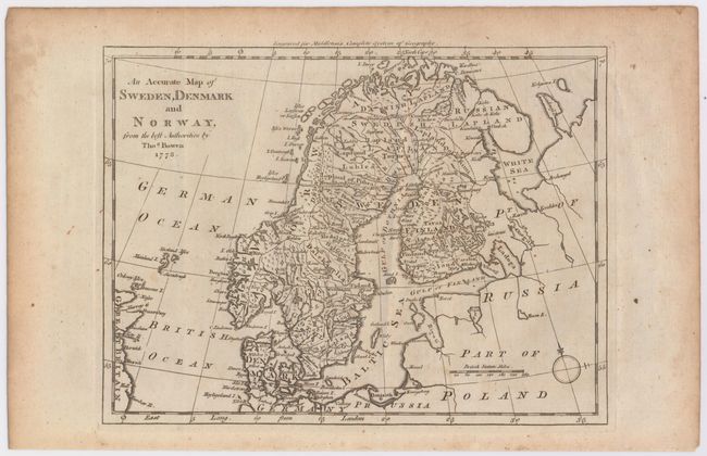
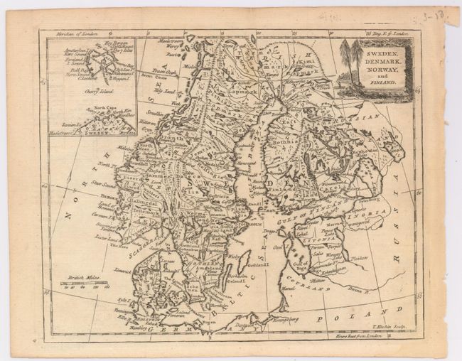
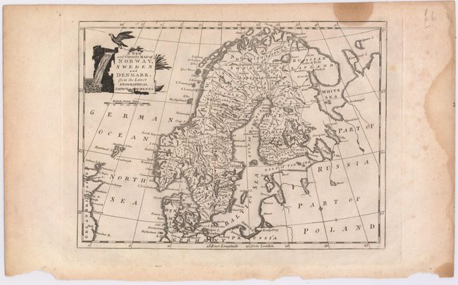
"[Lot of 4] A New and Accurate Map of Sweden and Norway [and] An Accurate Map of Sweden... [and] Sweden, Denmark, Norway, and Finland [and] A New and Correct Map of Norway, Sweden, and Denmark",
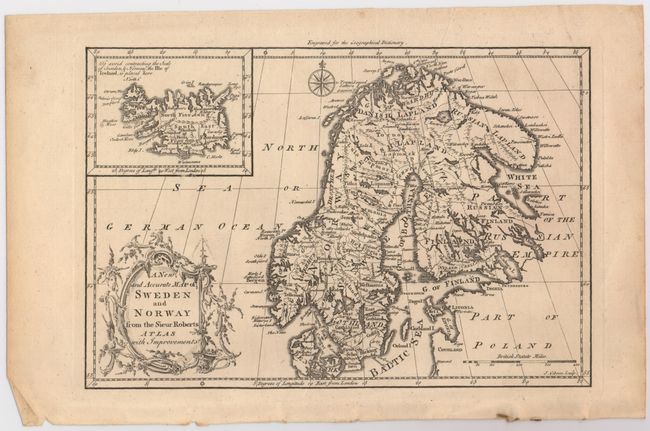
Subject: Scandinavia

Period: 1765-85 (circa)

Publication:

Color: Black & White

Size:
See Description
Download High Resolution Image
(or just click on image to launch the Zoom viewer)

A nice lot of eighteenth century maps of Scandinavia, each filled with details of towns, political boundaries, rivers, and topography.

A. A New and Accurate Map of Sweden and Norway from the Sieur Roberts Atlas with Improvements, by John Gibson, from Geographical Dictionary, circa 1765 (11.4 x 7.7"). Gibson's map includes an inset of Iceland and an ornate title cartouche. Condition: There is some light, extraneous creasing.

B. An Accurate Map of Sweden, Denmark and Norway, from the Best Authorities, by Thomas Bowen, from Middleton's Complete System of Geography, dated 1778 (10.6 x 8"). Reference: McCorkle (18th C. Geography Books) #280 Vol. II-2 (State 1). Condition: Very light soiling.

C. Sweden, Denmark, Norway, and Finland, by Thomas Kitchin, from Jonathan Carver's The New Universal Traveller, circa 1779 (8.9 x7.3"). Kitchin's map includes an inset of Spitsbergen and a decorative cartouche with a seaside scene. Reference: McCorkle (18th C. Geography Books) #37-9. Condition: Very light soiling.

D. A New and Correct Map of Norway, Sweden, and Denmark. From the Latest Geographical Improvements, by George Henry Millar, from The New and Universal System of Geography, circa 1785 (10.5 x 7.8"). Reference: McCorkle (18th C. Geography Books) #281-12 (State 2). Condition: A nice impression with a damp stain that enters map border at top right and another damp stain in far right margin.

References:

Condition: B+

See description above.

Estimate: $240 - $300

Sold for: $180

Closed on 9/4/2013

Archived