Catalog Archive
Auction 146, Lot 395

"Magnae Britanniae et Hiberniae Tabula", Hondius/Jansson
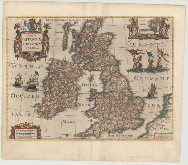
Subject: Britain

Period: 1636 (circa)

Publication: Gerardi Mercatoris Et I. Hondii Atlas…

Color: Hand Color

Size:
20.1 x 15.1 inches
51.1 x 38.4 cm
Download High Resolution Image
(or just click on image to launch the Zoom viewer)

A boldly embellished map of the British Isles densely packed with information. The beautifully engraved map includes an inset of the Orkney Islands enclosed in a cartouche flanked by putti. The map is further adorned with sailing ships, mermaids displaying armorial flags and elaborate title and distance scale cartouches. This was one of several maps introduced by Hondius and Jansson in response to increased competition from their rival Willem Blaeu. Although dated 1631, this map only appeared in the Hondius-Jansson Atlas between 1633 and 1644. This is from the English version published between 1636-41.

References: Shirley (BI to 1650) #435.

Condition: B+

A nice impression with attractive color and a long centerfold separation that has been professionally repaired. There is some faint show-through of text on verso and some minor soiling.

Estimate: $800 - $1,000

Sold for: $550

Closed on 9/4/2013

Archived