Catalog Archive
Auction 146, Lot 369

"A Chart of the Western and Southern Oceans Describing the Course of Sr. John Narbrough's Voyage to the South Sea", Robinson, Tancred

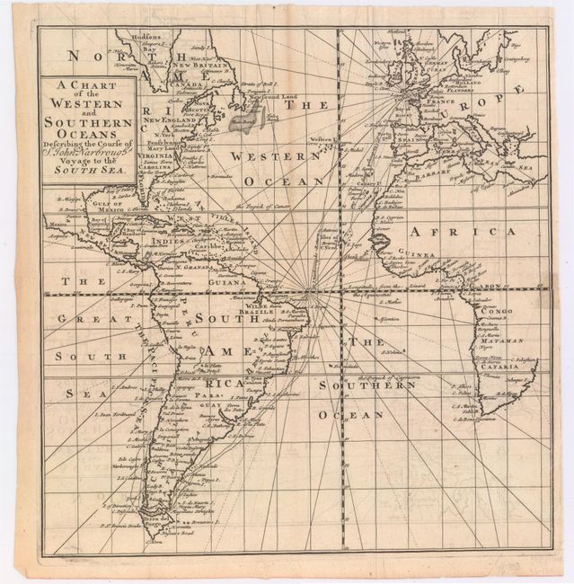
Subject: Atlantic Ocean

Period: 1711 (published)

Publication: An Account of Several Late Voyages and Discoveries

Color: Black & White

Size:
10 x 10.5 inches
25.4 x 26.7 cm
Download High Resolution Image
(or just click on image to launch the Zoom viewer)

Attractive chart centered on the Atlantic Ocean and showing the eastern part of North America, all of South America, and most of Europe and Africa. The tract of John Narbrough's voyage is shown from England, through the Strait of Magellan and to S. Mary Island off the coast of Chili; and returning along roughly the same route. Locates all principal harbors, island groups, capes, bays and banks. The Prime Meridian is shown through the Cape Verde Islands.

References:

Condition: B+

Issued folding, now pressed with light offsetting and minor toning. There is one very short tear that just enters map image at right that has been closed on verso with archival tape.

Estimate: $200 - $230

Sold for: $150

Closed on 9/4/2013

Archived