Catalog Archive
Auction 146, Lot 367

"Carte de la Partie Meridionale de l'Amerique Meridionale avec la Route du Centurion Depuis l'Isle Ste Catherine Jusqu'a l'Ile de Juan Fernandes…", Anson, George

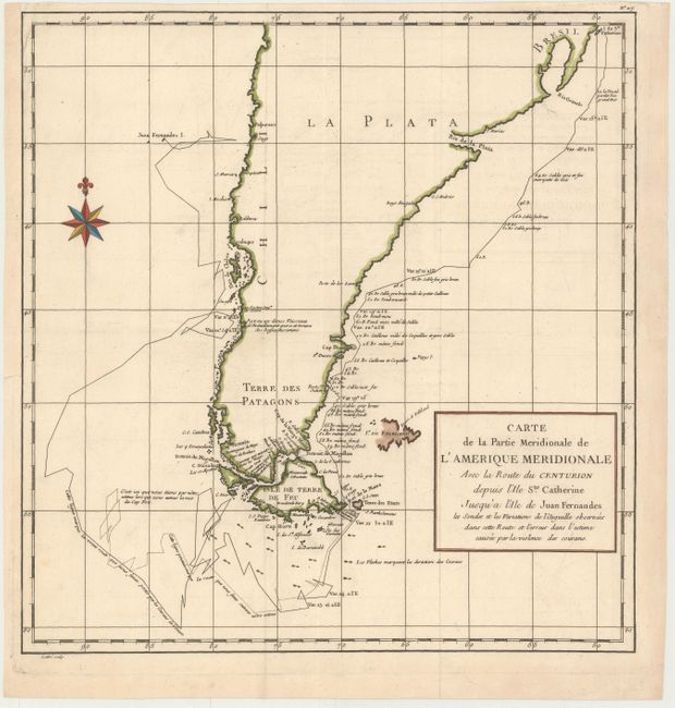
Subject: Southern South America

Period: 1787 (published)

Publication: Atlas Universel…

Color: Hand Color

Size:
16.4 x 17 inches
41.7 x 43.2 cm
Download High Resolution Image
(or just click on image to launch the Zoom viewer)

This handsome chart shows the route of Capt. George Anson's expedition from St. Catherine's Island off the coast of Brazil, around Cape Horn and up to Juan Fernandes Island (now known as Robinson Crusoe Island) off the coast of Chili. During the War of Jenkins' Ear, Anson's expedition of eight ships was sent to harass the Spaniards along the coast of South America. Seven of his ships were lost on the trek around Cape Horn and Chile with a loss of 600 men. Engraved by Lattre and published in Etienne Andre Philippe de Pretot's Atlas Universel.

References: Philipps (Atlases) #663-117.

Condition: A

Sharp impression on watermarked paper. Issued folded, now flattened with the binding trim on the upper left side replaced with old paper.

Estimate: $200 - $275

Unsold

Closed on 9/4/2013

Archived