Catalog Archive
Auction 146, Lot 313

"Carte de Lisle de Sainct Christophle...", Sanson/Mariette
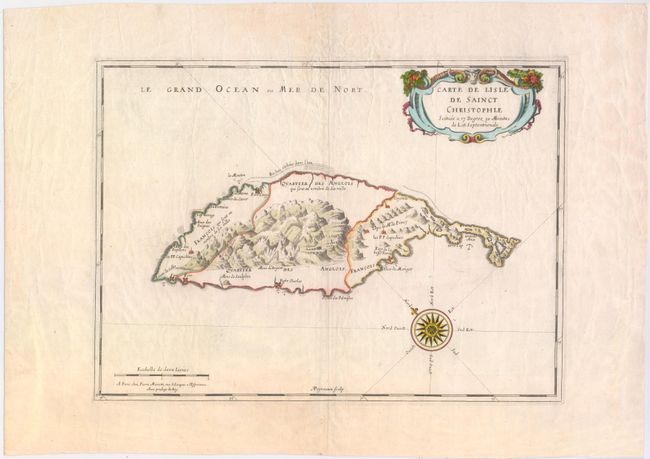
Subject: St. Kitts

Period: 1650 (circa)

Publication: Cartes Generales de Toutes les Parties du Monde…

Color: Hand Color

Size:
17 x 12.4 inches
43.2 x 31.5 cm
Download High Resolution Image
(or just click on image to launch the Zoom viewer)

The elegant map is the earliest printed map of St. Kitts. The island is divided into three parts with both extremities marked French and the central mountainous region demarked as English. The settlements and forts are clearly shown as well as the favorable anchorages and dangerous parts of the coastline. The island was first colonized in 1623 by the British and the French in 1627. The Anglo-French rivalry lasted for more than 100 years and both powers used the island as a base of operations in the Lesser Antilles. The map is beautifully embellished with a lovely compass rose and title cartouche. Engraved by A. Peyrounin.

References: Tooley (MCC-81) St. Kitts #1.

Condition: B+

Watermarked paper with wide margins and some light creasing.

Estimate: $700 - $850

Sold for: $400

Closed on 9/4/2013

Archived