Catalog Archive
Auction 146, Lot 240

"A Map of a Tract of Land in the State of New York Called Macomb's Purchase...", Gavit, John

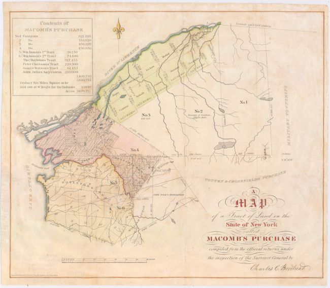
Subject: Northern New York

Period: 1853 (circa)

Publication:

Color: Hand Color

Size:
14.9 x 12.7 inches
37.8 x 32.3 cm
Download High Resolution Image
(or just click on image to launch the Zoom viewer)

In the aftermath of the American Revolutionary War, the state of New York was struggling financially and agreed to sell tracts of land. In 1791, Alexander Macomb, who had prospered during the war, purchased over 3.6 million acres of land in upstate New York, along the St. Lawrence River. The land purchase, named Macomb's Purchase, comprised approximately 1/8 of the entire state. Macomb's intent was to sell parcels of his land to developers, but he was not able to do so quickly enough to pay off his debt, and found himself in debtor's prison less than a year after the purchase. This map depicts Macomb's Purchase about 60 years later, identifying numerous land owners throughout. The table at top left indicates that six square miles of the tract near St. Regis had been reserved for the local Native American Indians, which remains an Indian Reservation to this day.

References:

Condition: B+

Issued folding, now pressed with minor archival repairs to a few folds and light soiling. A binding trim at bottom left has been replaced with old paper.

Estimate: $140 - $170

Unsold

Closed on 9/4/2013

Archived