Catalog Archive
Auction 146, Lot 232

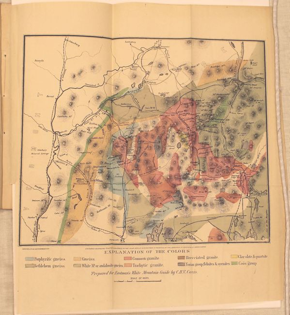
"[Untitled - Geologic Map of the White Mountains, New Hampshire]", Hitchcock, Charles Henry

Subject: New Hampshire

Period: 1872 (published)

Publication:

Color: Hand Color

Size:
5.8 x 9.1 inches
14.7 x 23.1 cm
Download High Resolution Image
(or just click on image to launch the Zoom viewer)

This map is the earliest detailed geologic map of the White Mountain region, showing Mount Washington, the highest peak in New England, as well as the Lafayette Range, Franconia Notch, "the flume" and the cog railway. The map also locates gold mines and other mineral deposits. Still bound in the 56 pp. report that describes the geology in detail entitled Report of the Geological Survey of the State of New Hampshire, Showing Its Progress During the Year 1871.

The Marcou reference book that discusses this map is also available in this auction, lot 853.

References: Marcou #225.

Condition: A

Map is near fine with a binding trim at lower left. Text is in good condition with light toning and an ex-library stamp on the front cover.

Estimate: $275 - $350

Sold for: $200

Closed on 9/4/2013

Archived