Catalog Archive
Auction 146, Lot 169

"The Middle States and Western Territories of the United States Including the Seat of the Western War", Carey, Mathew

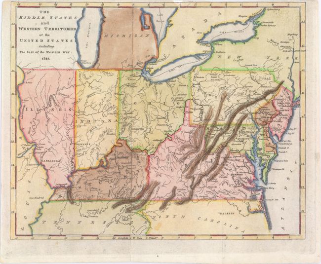
Subject: Mid-Atlantic & Central

Period: 1812 (dated)

Publication: Carey & Warner General Atlas

Color: Hand Color

Size:
9.6 x 7.8 inches
24.4 x 19.8 cm
Download High Resolution Image
(or just click on image to launch the Zoom viewer)

This rare copper engraved map covers the region from New Jersey to Illinois and names Indiana, Kentucky, Virginia, Ohio, Pennsylvania, Maryland, and Delaware. The northern borders of Illinois and Indiana are aligned with Ohio, so they are south of Lake Michigan. Chicago and Fort Dearborn are correctly on the lake, but occupy an unnamed region west of Lake Michigan. Michigan is named and Detroit is located. The capitols of Illinois, Indiana, and Ohio are given as Kaskaskia, Vincennes, and Chilicothe, respectively. The map was made to show the region involved in the War of 1812 with the British.

References:

Condition: B+

Very narrow top margin with a professionally repaired small chip entering map border with a small amount of neatline in facsimile. There is also a professionally closed short fold separation and a few printer's creases.

Estimate: $250 - $350

Sold for: $300

Closed on 9/4/2013

Archived