Catalog Archive
Auction 146, Lot 148

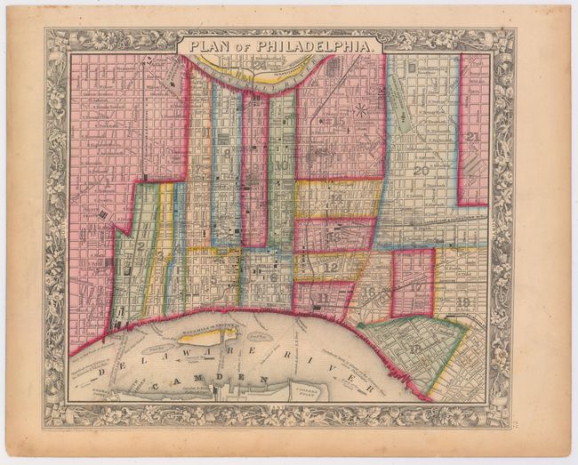
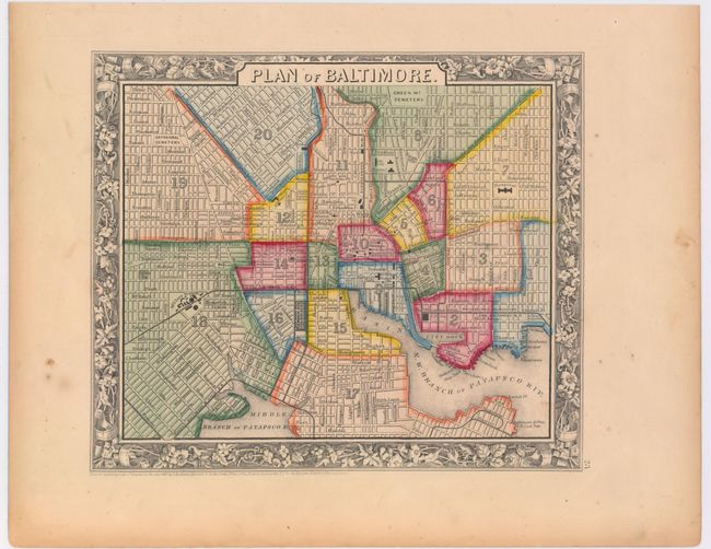
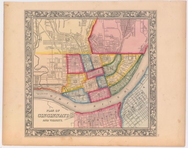
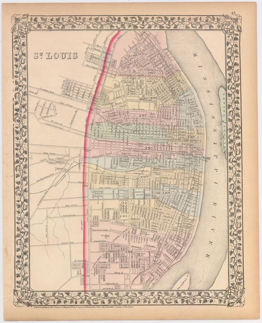
"[Lot of 4] Plan of Philadelphia [and] Plan of Baltimore [and] Plan of Cincinnati and Vicinity [and] St. Louis", Mitchell, Samuel Augustus

Subject: United States Cities

Period: 1860-74 (dated)

Publication:

Color: Hand Color

Size:
See Description
Download High Resolution Image
(or just click on image to launch the Zoom viewer)

This lot features maps of four important U.S. cities, all by Samuel Augustus Mitchell. Each map delineates city wards by hand color and provides excellent detail of the street grid, railroads and important buildings.

A. Plan of Philadelphia, dated 1860 (12.8 x 10.9").
B. Plan of Baltimore, dated 1860 (11.0 x 9.3").
C. Plan of Cincinnati and Vicinity, dated 1860 (11.1 x 10.6").
D. St. Louis, dated 1874 (11.2 x 14.2")

References:

Condition: B+

The maps are lightly toned with a few occasional spots. The map of St. Louis has a few small edge tears confined to the blank margins closed on verso with paper tape.

Estimate: $80 - $100

Sold for: $90

Closed on 9/4/2013

Archived