Catalog Archive
Auction 145, Lot 99

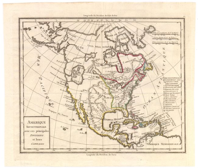
"Amerique Septentrionale avec ces Principales Divisions et Leurs Capitales", Mentelle, Edme

Subject: North America

Period: 1792 (circa)

Publication:

Color: Hand Color

Size:
11.2 x 9.2 inches
28.4 x 23.4 cm
Download High Resolution Image
(or just click on image to launch the Zoom viewer)

This uncommon map of North America shows an early United States with fourteen states named and keyed to an index at right, but the western boundaries are not depicted. The country's western boundary is shown along the Mississippi River. West of the Mississippi is under Spanish control, which is void of detail except for some rivers and mountains and a huge Mer de l’Ouest. The Pacific Northwest is shown without ownership claims and Alaska is still somewhat misshapen. The circa date of 1792 is based upon the map showing Vermont as a state, which occurred in 1791.

References: McGuirk #187.

Condition: A

Issued folding on watermarked paper with a binding trim at lower right that has been replaced with old paper.

Estimate: $275 - $350

Sold for: $200

Closed on 6/12/2013

Archived