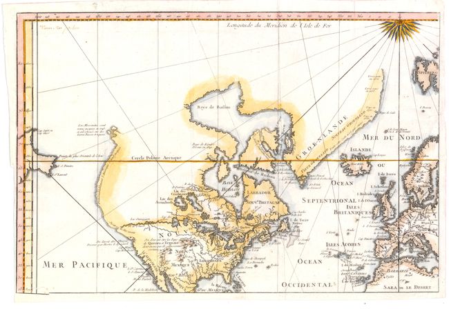
"[Top Left Sheet] Essay d'une Carte Reduite Contenant les Parties Connues du Globe Terrestre", Bellin, Jacques Nicolas
Subject: North America
Period: 1748 (circa)
Publication:
Color: Hand Color
Size:
14 x 9.3 inches
35.6 x 23.6 cm
This is the top left sheet of a four sheet map drawn on Mercator's Projection that covers nearly all of North America. The west is left largely blank, including coastlines that are only partially delineated and some which is speculative. There is no Sea of the West, but there is a River of the West flowing westward from Lake Winnipeg but ceasing before it meets the ocean. Discoveries are noted along the coasts and Quivira and Sante Fe are located in the interior. The full map measures 28 x 18.6".
References:
Condition: B+
Issued folding, now pressed on watermarked paper with a small chip in the lower left corner that has been repaired with archival material on verso. Narrow right margin.